


la verne

barney06
User
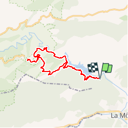

Length
17.7 km

Max alt
431 m

Uphill gradient
520 m
Km-Effort
25 km

Min alt
82 m

Downhill gradient
522 m
Boucle
Yes
Creation date :
2016-05-16 00:00:00.0
Updated on :
2016-05-16 00:00:00.0
6h50
Difficulty : Easy

FREE GPS app for hiking
 SityTrail
IGN / Geographical institutes
SityTrail Plus
The world is yours!
About
Trail Walking of 17.7 km to be discovered at Provence-Alpes-Côte d'Azur, Var, La Môle. This trail is proposed by barney06.
Description
monastère et lac
Positioning
Country:
France
Region :
Provence-Alpes-Côte d'Azur
Department/Province :
Var
Municipality :
La Môle
Location:
Unknown
Start:(Dec)
Start:(UTM)
292871 ; 4788991 (32T) N.
Comments